-
Book Overview & Buying
-
Table Of Contents

-
Feedback & Rating

ArcGIS Pro 3.x Cookbook
By :
ArcGIS Pro 3.x Cookbook
By:
Overview of this book
ArcGIS Pro, Esri's newest desktop GIS application, offers powerful tools for visualizing, maintaining, and analyzing data. This cookbook will help existing ArcMap users transition to ArcGIS Pro and teach new users how to utilize its GIS tools effectively. You’ll learn how to create geodatabases, convert data formats, link tables from outside sources, edit 2D and 3D data, ensure data integrity with topology, and enable advanced geodatabase behavior. By the end, you'll be able to effectively use ArcGIS Pro as your primary desktop GIS application, maintaining, analyzing, and displaying data using common methods and tools.
Table of Contents (17 chapters)
Preface

Chapter 1: ArcGIS Pro Capabilities and Terminology
 Free Chapter
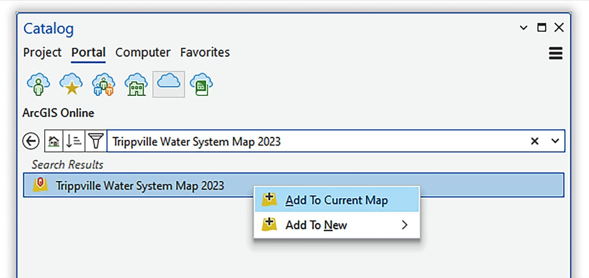
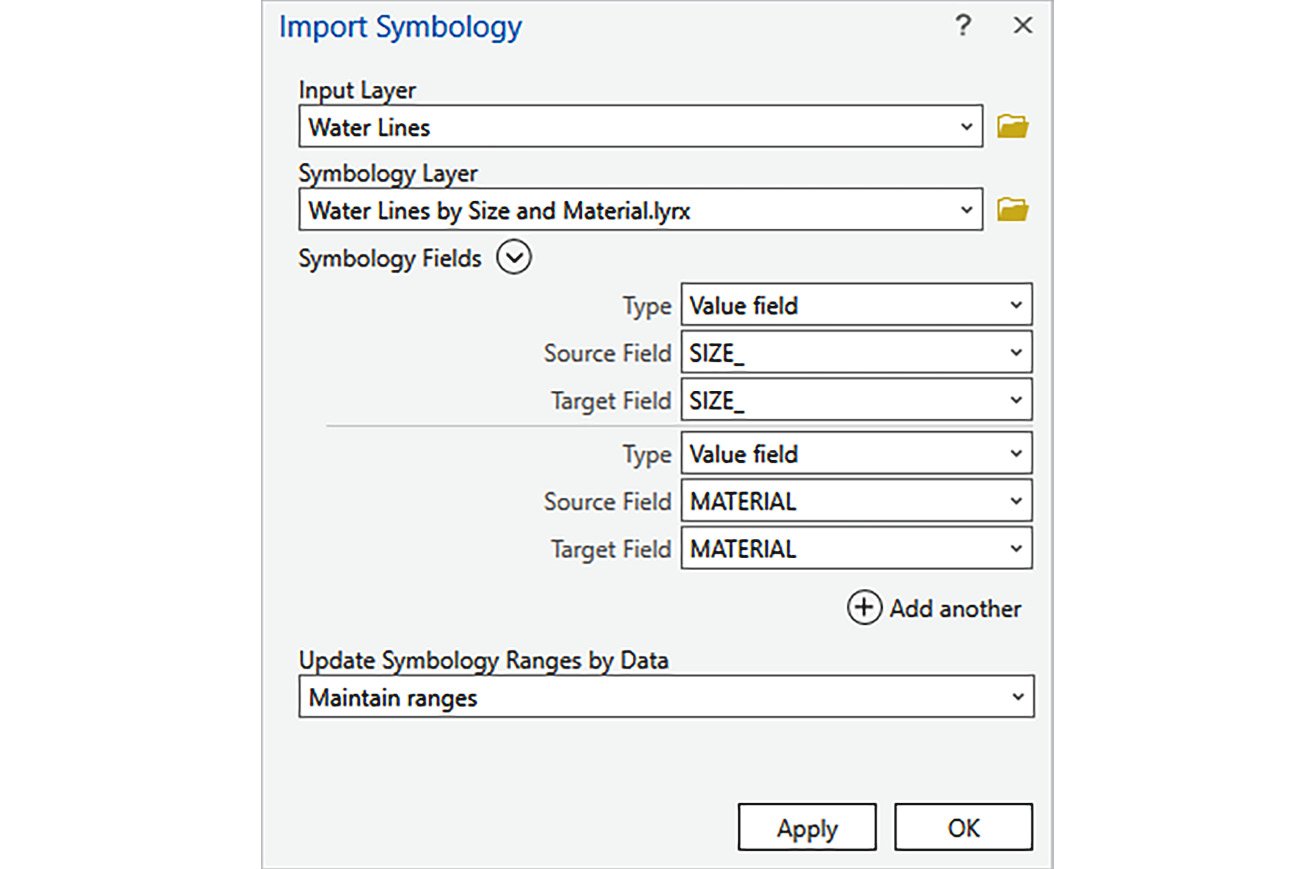
Chapter 2: Adding and Configuring Layers
Chapter 3: Linking Data Together
Chapter 4: Editing Existing Spatial Features
Chapter 5: Creating New Spatial Data
Chapter 6: Editing Tabular Data
Chapter 7: Projection and Coordinate System Basics
Chapter 8: Creating a Geodatabase
Chapter 9: Enabling Advanced Functionality in a Geodatabase
Chapter 10: Validating and Editing Data with Topologies
Chapter 11: Converting Data
Chapter 12: Proximity Analysis
Chapter 13: Spatial Statistics and Hotspots
Chapter 14: 3D Maps and Analysis
Index
Customer Reviews