Sign In Start Free Trial
Account

Add to playlist

Create a Playlist

Modal Close icon
You need to login to use this feature.
  • Learn QGIS
  • Toc
  • feedback
Learn QGIS

Learn QGIS

By : Cutts, Anita Graser
2 (1)
close
Learn QGIS

Learn QGIS

2 (1)
By: Cutts, Anita Graser

Overview of this book

QGIS 3.4 is the first LTR (long term release) of QGIS version 3. This is a giant leap forward for the project with tons of new features and impactful changes. Learn QGIS is fully updated for QGIS 3.4, covering its processing engine update, Python 3 de-facto coding environment, and the GeoPackage format. This book will help you get started on your QGIS journey, guiding you to develop your own processing pathway. You will explore the user interface, loading your data, editing, and then creating data. QGIS often surprises new users with its mapping capabilities; you will discover how easily you can style and create your first map. But that’s not all! In the final part of the book, you’ll learn about spatial analysis and the powerful tools in QGIS, and conclude by looking at Python processing options. By the end of the book, you will have become proficient in geospatial analysis using QGIS and Python.
Table of Contents (8 chapters)
close

Running QGIS for the first time

In recent years, QGIS has become the most popular open source desktop GIS software. Some people are using it just to view and query data, while others are using it for much deeper analyses. Maybe you are an ecologist or a town planner needing to use GIS as part of your job. Maybe you have a background in proprietary GIS software and want to migrate some of your common workflows to open source. Or maybe you are a student that needs to use GIS for a project. Whatever your driving reason is for opening this book, welcome to an amazing community that is passionate about open source and GIS.

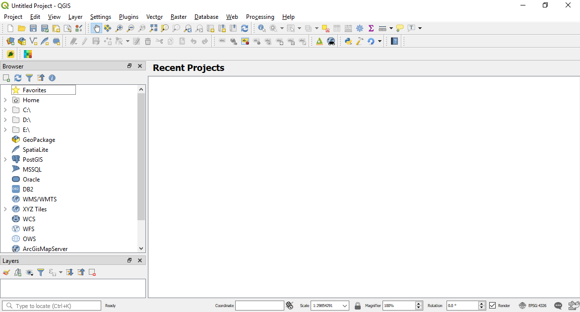
The following screenshot shows how QGIS 3.4 will look when it is first opened. In this case, there are no recent projects here and the interface is uncustomized:

How QGIS appears once opened for the first time

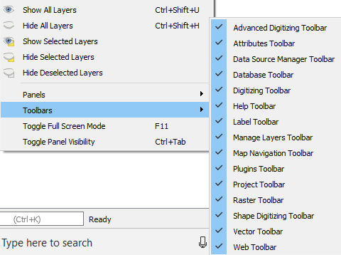
On the first run, not all toolbars are enabled. You can enable all the default toolbars (meaning the ones not associated with any additional plugins) via Toolbars in the View menu. Set up the QGIS environment according to your personal preferences via the Toolbars option shown in the following screenshot:

Setting the toolbars
Leave the default settings enabled for this book. We will guide you through the toolbars and panels in detail in later sections.

Plugins

Plugins are a unique feature of QGIS. In Chapter 6, Extending QGIS with Python, we will cover how to build your own. Plugins are available to be installed as you need them to enable further analysis. If what you want to do is not available within your current QGIS setup, search in the plugins as someone may have developed a tool to help you reach your solution. To access the Plugins, navigate to Plugins in the menu and then select Manage and Install Plugins:

Opening the Plugins menu

By clicking on the preceding option, the following window will be displayed:

List of plugins currently installed

The Plugins window will display the number of plugins installed in parentheses. In the preceding example, 272 are shown. You can search for plugins in the search box, install or upgrade individual plugins, or Upgrade All. Plugins are activated by ticking the check boxes beside their names. In QGIS 3.4, an icon will appear in the bottom-right corner of the information bar if there are any updates available for the your installed plugins.

For a list of all the available Plugins, including the latest and most popular, navigate to https://plugins.qgis.org/. This is an ever-growing list!
bookmark search playlist download font-size

Change the font size

margin-width

Change margin width

day-mode

Change background colour

Close icon Search
Country selected

Close icon Your notes and bookmarks

Delete Bookmark

Modal Close icon
Are you sure you want to delete it?
Cancel
Yes, Delete